Beehive Falls Track
Beehive Falls — 2.8km return, mostly flat, leading to a 25m drop waterfall in the heart of the northern Grampians. Best after winter rain. Pets and bikes not permitted.
| Distance | 2.8km return |
|---|---|
| Time | 75 min |
| Elevation | ~80m gain |
| Difficulty | Easy to moderate |
| Best time | June–November |
| Start | Roses Gap car park (Mt Difficult Road, signposted) |
The track
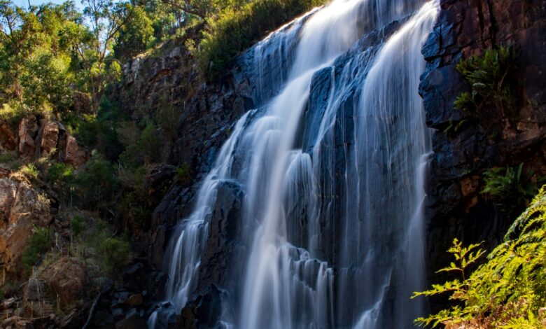
From the car park follow signs to Beehive Falls. The first 1km is well-graded through stringybark forest and creek-side ferns. The track narrows in the final 400m as it climbs gently toward the cliff base. The falls drop over a distinctive rounded sandstone formation — the “beehive” — to a small pool below.
What you see
A clean 25m vertical waterfall in winter and early spring. In late summer the flow becomes a trickle and the rounded sandstone is the main visual.
Safety
Slippery rocks at the base — stay on the marked viewing platform. No swimming. No pets, no bikes.
Onward option
The Briggs Bluff hike continues from the same car park as a 9km full-day option — see our separate Briggs Bluff guide.
What to bring
1.5L water, closed shoes, light rain shell in winter.